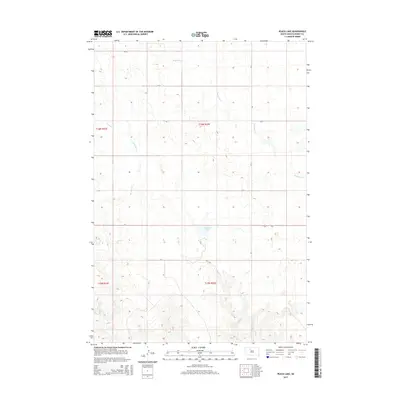
2015 Map of Peach Lake
USGS Topo · Published 2015About this map
Peach Lake sits at the center of this Ziebach County landscape, serving as a primary landmark in a region defined by its complex drainage network. The hydrology of the area is dominated by the winding paths of Redwater Cr and Meadow Cr, which carve through the terrain as part of the larger Cheyenne River watershed system. In the southern portion of the quadrangle, the headwaters of Red Earth Cr emerge, further emphasizing the importance of these seasonal and permanent watercourses to the local ecology. The map reveals a sparse, rural road infrastructure including Cr-3a, Cr-3, and Cr-5, which largely follow section lines established by the Public Land Survey System. These routes connect isolated points across the prairie, reflecting the enduring grid-based settlement patterns of South Dakota's western plains.
Find a feature on this map
13 named features on this map. Tap any name to fly to it.
Don’t see what you’re looking for? This feature index may not catch every label — zoom into the map to look around manually.
Map Details
Editions of this 2015 Peach Lake Map
This is the sole edition of this map. No revisions or reprints were ever made.
Other maps of this area

1952 · Lantry NW
USGS Topo · 1:24,000

1952 · Lantry NE
USGS Topo · 1:24,000

1952 · Parade NW
USGS Topo · 1:24,000

1953 · McIntosh
USGS Topo · 1:250,000

1958 · McIntosh
USGS Topo · 1:250,000

1978 · Brewer Butte
USGS Topo · 1:24,000

1978 · Isabel SW
USGS Topo · 1:24,000

1978 · Peach Lake
USGS Topo · 1:24,000

1978 · Isabel
USGS Topo · 1:24,000

1978 · Livermant Lake
USGS Topo · 1:24,000