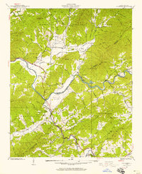
1937 Map of Peachtree
USGS Topo · Published 1957About this map
Brasstown and Peachtree serve as central points in this 1937 survey of the western North Carolina mountain country, where the Hiwassee River winds through fertile tracts like Harshaw Bottom and Suddewig Bottom. The landscape is a mix of agricultural valleys and the high ridges of the Nantahala National Forest, including heights like Mumblehead Top and Plot Knob.
Find a feature on this map
95 named features on this map. Tap any name to fly to it.
Don’t see what you’re looking for? This feature index may not catch every label — zoom into the map to look around manually.
Map Details
Editions of this 1937 Peachtree Map
4 editions found
Other maps of this area

1886 · Dahlonega
USGS Topo · 1:125,000

1888 · Ellijay
USGS Topo · 1:125,000

1892 · Dahlonega
USGS Topo · 1:125,000

1892 · Ellijay
USGS Topo · 1:125,000

1893 · Murphy
USGS Topo · 1:125,000

1896 · Dahlonega
USGS Topo · 1:125,000

1898 · Ellijay
USGS Topo · 1:125,000

1903 · Dahlonega
USGS Topo · 1:125,000

1911 · Ellijay
USGS Topo · 1:125,000

1914 · Murphy
USGS Topo · 1:125,000