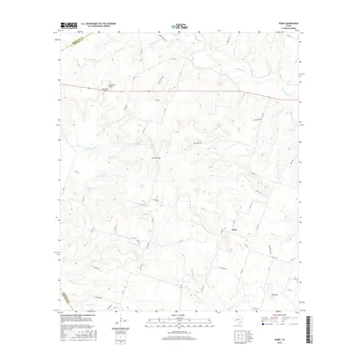
2016 Map of Pearl
USGS Topo · Published 2016About this map
Pearl sits at the intersection of rural ranch roads in this Central Texas landscape, where the headwaters of several significant creek systems originate. The terrain is defined by prominent high points and passes, including Fletchers Point and the strategic Live Oak Gap, which likely influenced early travel routes through the region. Water remains the primary shaper of this environment, with the winding paths of Cowhouse Cr and N Bee House Cr cutting through the limestone-influenced topography. Numerous named water sources like Old Cottonwood Spring and Kendrick Spring indicate the critical importance of reliable water in this ranching country. The map also records the jurisdictional boundaries where Coryell County meets Hamilton and Lampasas counties, illustrating the settlement pattern across these high divides and drainage basins such as Cromeans Cr and Bullard Cr.
Find a feature on this map
63 named features on this map. Tap any name to fly to it.
Don’t see what you’re looking for? This feature index may not catch every label — zoom into the map to look around manually.
Map Details
Editions of this 2016 Pearl Map
This is the sole edition of this map. No revisions or reprints were ever made.
Other maps of this area

1887 · Lampasas
USGS Topo · 1:125,000

1888 · Hamilton
USGS Topo · 1:125,000

1888 · Meridian
USGS Topo · 1:125,000

1894 · Hamilton
USGS Topo · 1:125,000

1894 · Meridian
USGS Topo · 1:125,000

1894 · Lampasas
USGS Topo · 1:125,000

1894 · Gatesville
USGS Topo · 1:125,000

1947 · Purmela
USGS Topo · 1:62,500

1947 · Pidcoke
USGS Topo · 1:24,000

1947 · Purmela
USGS Topo · 1:24,000