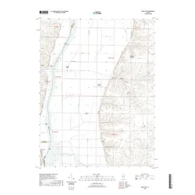
2018 Map of Pearl East
USGS Topo · Published 2018About this map
Hillview and the village of Pearl flank the wide floodplain of the Illinois River, where a complex network of islands and creeks defines the border between Pike, Greene, and Calhoun Counties. The landscape transition is sharp, moving from the level bottomlands around Grand Pass and Hartwell Ranch to the dissected bluffs on the eastern side of the river. These uplands are characterized by prominent drainages such as Scott Hollow and Garrison Hollow, which provided the secluded locations for several family and community burial grounds including Shelton Cem, Likely Cem, and Bridgewater Cem. Along the lower reaches, Apple Creek meanders toward its confluence with the river near Twin Islands. The mapping of small-scale operations like McClay Orchard and the Hartwell Ranch RLA Airport reflects the continued agricultural and private aviation character of this riverine corridor during the early twenty-first century.
Find a feature on this map
82 named features on this map. Tap any name to fly to it.
Don’t see what you’re looking for? This feature index may not catch every label — zoom into the map to look around manually.
Map Details
Editions of this 2018 Pearl East Map
This is the sole edition of this map. No revisions or reprints were ever made.
Other maps of this area

1924 · Winchester
USGS Topo · 1:48,000

1924 · Roodhouse
USGS Topo · 1:62,500

1924 · Griggsville
USGS Topo · 1:62,500

1926 · Griggsville
USGS Topo · 1:62,500

1926 · Winchester
USGS Topo · 1:62,500

1926 · Roodhouse
USGS Topo · 1:62,500

1930 · Pearl
USGS Topo · 1:62,500

1948 · Quincy
USGS Topo · 1:250,000

1950 · Pearl
USGS Topo · 1:62,500

1956 · Quincy
USGS Topo · 1:250,000