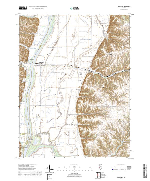
2024 Map of Pearl East
USGS Topo · Published 2024About this map
The Illinois River creates a wide, fertile floodplain in this section of Greene and Pike counties, defining the agricultural character of the region. On the eastern bank, the village of Hillview sits at the foot of steep bluffs, where numerous family cemeteries like Shelton Cem and Bluefield Cem are tucked into the rising terrain. The map captures a landscape shaped by both the river and the bluffs, with drainage features like Hurricane Creek and Apple Creek cutting through the lowlands.
Find a feature on this map
50 named features on this map. Tap any name to fly to it.
Don’t see what you’re looking for? This feature index may not catch every label — zoom into the map to look around manually.
Map Details
Editions of this 2024 Pearl East Map
This is the sole edition of this map. No revisions or reprints were ever made.
Other maps of this area

1924 · Winchester
USGS Topo · 1:48,000

1924 · Roodhouse
USGS Topo · 1:62,500

1924 · Griggsville
USGS Topo · 1:62,500

1926 · Griggsville
USGS Topo · 1:62,500

1926 · Winchester
USGS Topo · 1:62,500

1926 · Roodhouse
USGS Topo · 1:62,500

1930 · Pearl
USGS Topo · 1:62,500

1948 · Quincy
USGS Topo · 1:250,000

1950 · Pearl
USGS Topo · 1:62,500

1956 · Quincy
USGS Topo · 1:250,000