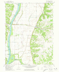
1980 Map of Pearl East
USGS Topo · Published 1981About this map
The Illinois River corridor dominates this landscape, serving as a political boundary between Greene, Pike, and Calhoun counties. In the early 1980s, the river plain was a complex network of levees and water features like Weson Island and Wing Slough. Industry and transport follow the river's path, most notably the Illinois Central Gulf railroad which passes through the community of Hillview. The eastern bluffs are deeply incised by hollows such as Bridgewater Hollow and Scott Hollow, where many local family burial grounds are located, including Shelton Cem and Bridgewater Cem.
Find a feature on this map
44 named features on this map. Tap any name to fly to it.
Don’t see what you’re looking for? This feature index may not catch every label — zoom into the map to look around manually.
Map Details
Editions of this 1980 Pearl East Map
This is the sole edition of this map. No revisions or reprints were ever made.
Other maps of this area

1924 · Winchester
USGS Topo · 1:48,000

1924 · Roodhouse
USGS Topo · 1:62,500

1924 · Griggsville
USGS Topo · 1:62,500

1926 · Griggsville
USGS Topo · 1:62,500

1926 · Winchester
USGS Topo · 1:62,500

1926 · Roodhouse
USGS Topo · 1:62,500

1930 · Pearl
USGS Topo · 1:62,500

1948 · Quincy
USGS Topo · 1:250,000

1950 · Pearl
USGS Topo · 1:62,500

1956 · Quincy
USGS Topo · 1:250,000