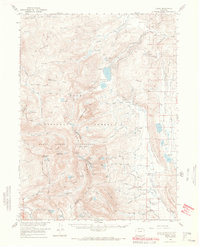
1956 Map of Pearl
USGS Topo · Published 1969About this map
Pearl sits at the northern edge of this high-altitude landscape, where the mining industry and ranching culture of northern Colorado met at the mid-century. The map documents the extraction history of the Park Range and the Sawtooth Range, notably featuring the Zirkel Mine, the Wolverine Mine, and the Swede Group Mines. A Smelter Stack near the settlement of Pearl serves as a prominent landmark of the era's mineral processing.
Find a feature on this map
98 named features on this map. Tap any name to fly to it.
Don’t see what you’re looking for? This feature index may not catch every label — zoom into the map to look around manually.
Map Details
Editions of this 1956 Pearl Map
2 editions found

Other maps of this area

1906 · Medicine Bow
USGS Topo · 1:125,000

1908 · Medicine Bow
USGS Topo · 1:125,000

1911 · Hahns Peak
USGS Topo · 1:125,000

1913 · Hahns Peak
USGS Topo · 1:125,000

1939 · Saratoga
USGS Topo · 1:125,000

1954 · Rawlins
USGS Topo · 1:250,000

1954 · Craig
USGS Topo · 1:250,000

1955 · Davis Peak
USGS Topo · 1:24,000

1955 · Independence Mountain
USGS Topo · 1:24,000

1955 · Lake John
USGS Topo · 1:24,000