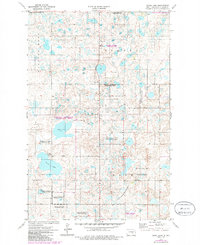
1972 Map of Pearl Lake
USGS Topo · Published 1986About this map
Glacial prairie potholes and wetlands dominate this portion of the Stutsman County landscape, characterized by the irregular terrain of Marston Moor, Strong, and Iosco. Much of the map is dedicated to conservation, with numerous parcels designated as National Waterfowl Production Area, reflecting the region's importance within the North American migratory flyway. These protected wetlands surround significant water bodies like Pearl Lake and Mud Lake.
Find a feature on this map
13 named features on this map. Tap any name to fly to it.
Don’t see what you’re looking for? This feature index may not catch every label — zoom into the map to look around manually.
Map Details
Editions of this 1972 Pearl Lake Map
2 editions found
Other maps of this area

1952 · New Rockford
USGS Topo · 1:250,000

1953 · Jamestown
USGS Topo · 1:250,000

1954 · Cleveland NW
USGS Topo · 1:24,000

1954 · Medina
USGS Topo · 1:24,000

1955 · Crystal Springs
USGS Topo · 1:24,000

1956 · New Rockford
USGS Topo · 1:250,000

1956 · Jamestown
USGS Topo · 1:250,000
1958 · Goldwin SW
USGS Topo · 1:24,000

1958 · Goldwin
USGS Topo · 1:24,000

1971 · New Rockford
USGS Topo · 1:250,000