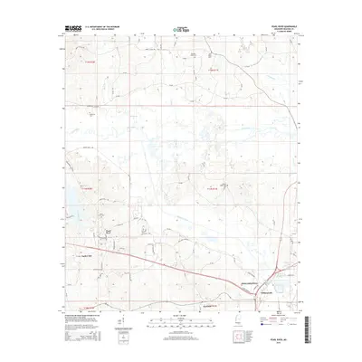
2015 Map of Pearl River
USGS Topo · Published 2015About this map
Philadelphia, Mississippi, serves as a focal point for this Neshoba County survey, where the landscape is defined by the winding course of the Pearl River and the engineered Kentawka Canal. The terrain north of the city is marked by a network of rural routes such as Marty Stuart Dr and Hooper Mill Creek Rd, connecting small settlements like Zephyr Hill and Fairview. Genealogists will find a high concentration of burial sites throughout the quadrangle, including the Old Pearl Valley Cem, Black Jack Cem, and Henrys Chapel Cem. The hydrology of the area is complex, with several tributaries such as Wolf Cr, Jofuska Cr, and Pinishook Cr feeding into the river system. The southern edge of the map shows the transition into Williamsville, illustrating the local infrastructure of highways and industrial roads like Indian Hills Cir that support the region's modern development.
Find a feature on this map
96 named features on this map. Tap any name to fly to it.
Don’t see what you’re looking for? This feature index may not catch every label — zoom into the map to look around manually.
Map Details
Editions of this 2015 Pearl River Map
This is the sole edition of this map. No revisions or reprints were ever made.
Other maps of this area

1953 · Meridian
USGS Topo · 1:250,000

1957 · Meridian
USGS Topo · 1:250,000

1962 · Edinburg
USGS Topo · 1:62,500

1965 · Meridian
USGS Topo · 1:250,000

1972 · Pearl River
USGS Topo · 1:24,000

1972 · Plattsburg
USGS Topo · 1:24,000
1972 · Noxapater
USGS Topo · 1:24,000

1972 · Deemer
USGS Topo · 1:24,000
1972 · Philadelphia
USGS Topo · 1:24,000

1972 · Madden
USGS Topo · 1:24,000