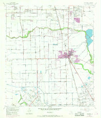
1955 Map of Pearland
USGS Topo · Published 1970About this map
Pearland emerges as a developing hub along the Atchison Topeka and Santa Fe railroad line, straddling the boundary between Harris and Brazoria Counties. This survey, updated with late-1960s data, illustrates the transition from an extraction-based economy toward suburban expansion, visible in the residential grid of Skyscraper Shadows and the presence of a Drive-in Theater. Petroleum production remains a dominant geographic force, with the sprawling Mykawa Oil Field and Hastings Oil Field dotting the landscape with wells and tanks. Local infrastructure is anchored by the Pearland Airport and institutional landmarks like the Bunch Sch and High Sch. Natural drainage is defined by the winding course of Clear Creek and Hickory Slough, while the American Canal and various spoil banks reflect significant human alteration of the coastal prairie to manage water and industrial needs.
Find a feature on this map
27 named features on this map. Tap any name to fly to it.
Don’t see what you’re looking for? This feature index may not catch every label — zoom into the map to look around manually.
Map Details
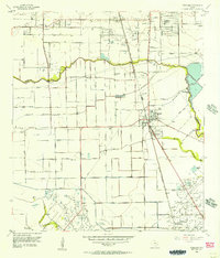
Editions of this 1955 Pearland Map
2 editions found
Other maps of this area

1915 · Bellaire
USGS Topo · 1:24,000

1915 · Park Place
USGS Topo · 1:24,000

1915 · Deepwater
USGS Topo · 1:24,000

1916 · Genoa
USGS Topo · 1:24,000

1919 · Deepwater
USGS Topo · 1:31,680

1920 · Genoa
USGS Topo · 1:31,680

1920 · Mykawa
USGS Topo · 1:31,680

1920 · Almeda
USGS Topo · 1:31,680

1921 · Bellaire
USGS Topo · 1:31,680

1922 · Park Place
USGS Topo · 1:31,680