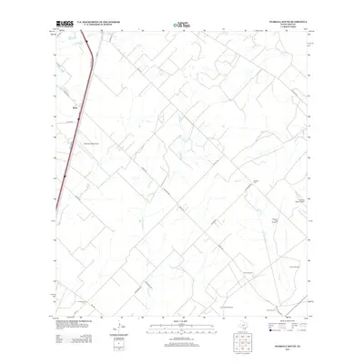
2013 Map of Pearsall South
USGS Topo · Published 2013About this map
The community of Melon serves as a northern anchor in this Frio County landscape, situated along the frontage roads of the Interstate corridor. South of the town, the terrain is defined by a sparse but structured network of ranching and irrigation infrastructure, including several named water-pumping points like Shipping Trap Windmill, Prairie Windmill, and the Jim and Roy Windmill. These features reflect the area's ongoing reliance on groundwater for livestock and land management.
Find a feature on this map
29 named features on this map. Tap any name to fly to it.
Don’t see what you’re looking for? This feature index may not catch every label — zoom into the map to look around manually.
Map Details
Editions of this 2013 Pearsall South Map
This is the sole edition of this map. No revisions or reprints were ever made.
Other maps of this area

1925 · Pearsall 1-b
USGS Topo · 1:48,000

1925 · Pearsall 1-c
USGS Topo · 1:48,000

1927 · Pearsall
USGS Topo · 1:62,500

1934 · Schattel
USGS Topo · 1:62,500

1942 · Dilley
USGS Topo · 1:62,500

1953 · Crystal City
USGS Topo · 1:250,000

1955 · Crystal City
USGS Topo · 1:250,000

1956 · Hindes
USGS Topo · 1:62,500

1961 · Crystal City
USGS Topo · 1:250,000

1964 · Pearsall South
USGS Topo · 1:24,000