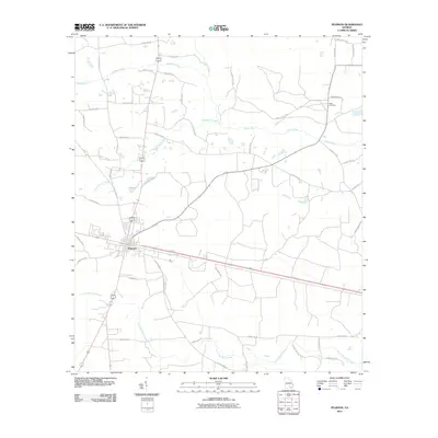
2011 Map of Pearson
USGS Topo · Published 2011About this map
Pearson serves as the central hub of this South Georgia landscape, where several major transit lines and local streets like E Austin Ave and Bolden St converge. The town's grid is oriented alongside E Railroad Ave, illustrating the historical importance of the rail corridor to the local economy. Beyond the settlement, the terrain is defined by a dense network of blackwater streams and river systems, most notably the Satilla River which winds through the eastern portion of the quadrangle. These waterways, including Sweetwater Creek, Pudding Creek, and Little Red Bluff Creek, create a fragmented landscape of low-lying basins. Local history is anchored by the Kight Cemetery to the northeast, while a web of rural routes such as Smut Hammick Rd and Guthrie Hyatt Rd connect the outlying farmsteads and timberlands to the town center.
Find a feature on this map
46 named features on this map. Tap any name to fly to it.
Don’t see what you’re looking for? This feature index may not catch every label — zoom into the map to look around manually.
Map Details
Editions of this 2011 Pearson Map
This is the sole edition of this map. No revisions or reprints were ever made.
Other maps of this area

1953 · Waycross
USGS Topo · 1:250,000

1958 · Waycross
USGS Topo · 1:250,000

1968 · Cogdell
USGS Topo · 1:24,000

1971 · Douglas South
USGS Topo · 1:24,000

1971 · Wilsonville
USGS Topo · 1:24,000

1971 · Axson
USGS Topo · 1:24,000

1971 · Pearson
USGS Topo · 1:24,000

1972 · Kirkland
USGS Topo · 1:24,000

1972 · Sandy Bottom
USGS Topo · 1:24,000

1972 · Henderson Still
USGS Topo · 1:24,000