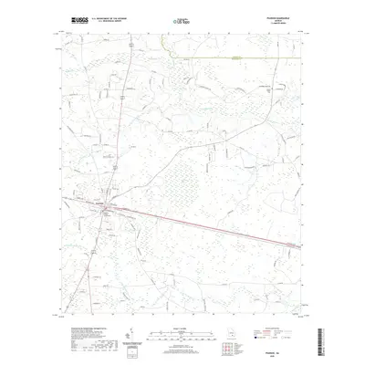
2020 Map of Pearson
USGS Topo · Published 2020About this map
Pearson serves as the focal point of this South Georgia landscape, situated within the flatwoods and wetlands typical of the coastal plain. The town's grid is centered around the Atkinson County Courthouse, reflecting its role as a regional seat of government. Waterways define the surrounding territory, with the Satilla River meandering across the northern half, joined by smaller tributaries like Sweetwater Creek and Pudding Creek. These streams are set against a backdrop of low-lying features such as Ricketson Bay and Little Red Bluff Creek, illustrating the complex drainage patterns of the area. Rural life is evidenced by the network of country roads named for local families and landmarks, such as Gutherie Heights Rd and Jowers Chapel Cem. This modern survey provides a detailed look at the interface between the established town and the extensive pine-dominated wetlands that have long shaped the local economy.
Find a feature on this map
106 named features on this map. Tap any name to fly to it.
Don’t see what you’re looking for? This feature index may not catch every label — zoom into the map to look around manually.
Map Details
Editions of this 2020 Pearson Map
This is the sole edition of this map. No revisions or reprints were ever made.
Other maps of this area

1953 · Waycross
USGS Topo · 1:250,000

1958 · Waycross
USGS Topo · 1:250,000

1968 · Cogdell
USGS Topo · 1:24,000

1971 · Douglas South
USGS Topo · 1:24,000

1971 · Wilsonville
USGS Topo · 1:24,000

1971 · Axson
USGS Topo · 1:24,000

1971 · Pearson
USGS Topo · 1:24,000

1972 · Kirkland
USGS Topo · 1:24,000

1972 · Sandy Bottom
USGS Topo · 1:24,000

1972 · Henderson Still
USGS Topo · 1:24,000