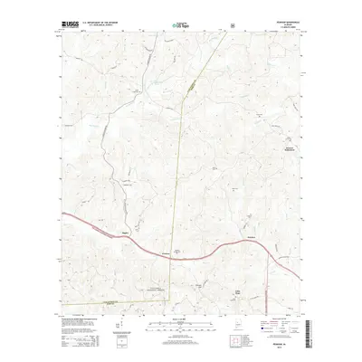
2014 Map of Pearson
USGS Topo · Published 2014About this map
Stewart Settlement and Little Hope occupy a landscape deeply etched by the drainage basins of Big Sandy Cr and Bear Cr within the Talladega National Forest. This 2014 survey reveals a rural network of cemeteries and small settlements clustered along the Us-82 corridor and winding county roads. The topography is defined by significant ridges and gaps, most notably Pearson Gap, which influences the path of the local thoroughfares. Genealogists and local researchers will find a high concentration of burial sites, including Hubbard Springs Cem, Sandy Creek Cem, and Burns Cem, scattered throughout the timbered hills. The presence of Big Sandy Spring and numerous named branches like Mill Br and Horse Br underscores the importance of natural water sources in the historical development of these Tuscaloosa and Bibb County communities.
Find a feature on this map
55 named features on this map. Tap any name to fly to it.
Don’t see what you’re looking for? This feature index may not catch every label — zoom into the map to look around manually.
Map Details
Editions of this 2014 Pearson Map
This is the sole edition of this map. No revisions or reprints were ever made.
Other maps of this area

1899 · Brookwood
USGS Topo · 1:125,000

1931 · Cottondale
USGS Topo · 1:48,000

1934 · Cottondale
USGS Topo · 1:62,500

1934 · Blocton
USGS Topo · 1:48,000

1940 · Blocton
USGS Topo · 1:62,500

1953 · Montgomery
USGS Topo · 1:250,000

1953 · Birmingham
USGS Topo · 1:250,000

1956 · Birmingham
USGS Topo · 1:250,000

1956 · Montgomery
USGS Topo · 1:250,000

1957 · Birmingham
USGS Topo · 1:250,000