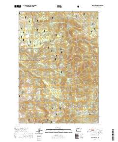
2020 Map of Pearson Ridge
USGS Topo · Published 2020About this map
Pearson Ridge serves as a central spine in this section of the Umatilla National Forest, where a network of water sources and high-elevation meadows supported local land use into the early 21st century. Named springs like Scott Spring, Hunter Spring, and the uniquely titled White Pine Trough Spring are dispersed throughout the terrain, feeding numerous drainages including Hidaway Cr and Neeves Cr.
Find a feature on this map
42 named features on this map. Tap any name to fly to it.
Don’t see what you’re looking for? This feature index may not catch every label — zoom into the map to look around manually.
Map Details
Editions of this 2020 Pearson Ridge Map
This is the sole edition of this map. No revisions or reprints were ever made.
Other maps of this area

1951 · Dale
USGS Topo · 1:62,500

1951 · Desolation Butte
USGS Topo · 1:62,500

1953 · Pendleton
USGS Topo · 1:250,000

1955 · Canyon City
USGS Topo · 1:250,000

1956 · Pendleton
USGS Topo · 1:250,000

1959 · Canyon City
USGS Topo · 1:250,000

1967 · Ukiah SE
USGS Topo · 1:24,000

1967 · Tower Mtn
USGS Topo · 1:24,000

1967 · Sullivan Gulch
USGS Topo · 1:24,000

1967 · Lehman Springs
USGS Topo · 1:24,000