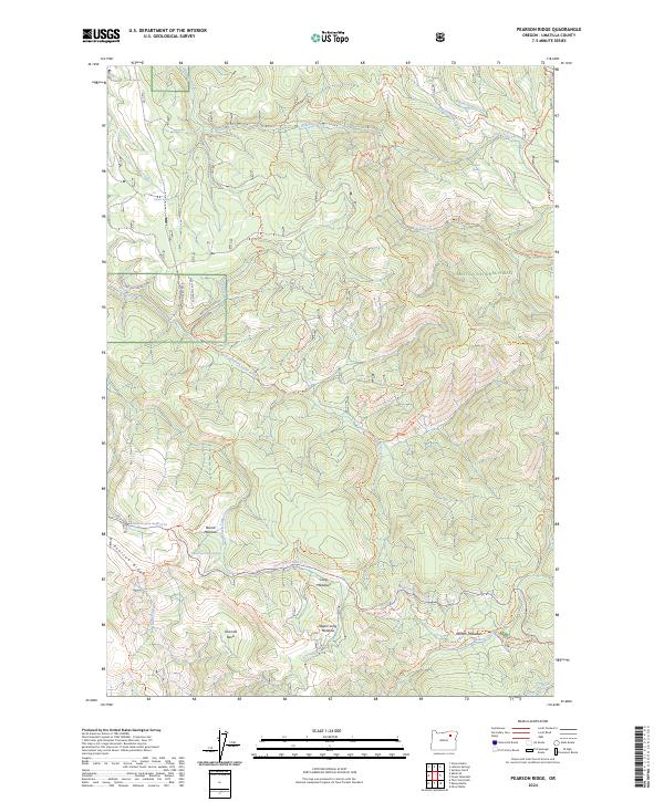
2024 Map of Pearson Ridge
USGS Topo · Published 2024About this map
Umatilla National Forest encompasses this high-elevation terrain in eastern Oregon, where a dense network of forest service roads and historic pack trails defines the landscape. The south and east portions of the map are preserved within the North Fork John Day Wilderness, a roadless area where drainage systems like Winom Creek and North Fork Cable Creek descend through steep canyons. This geography creates isolated pockets of flat ground such as Round Meadow, Oriental Basin, and the tiered Long Meadows and Upper Long Meadow. These openings in the timber were often vital landmarks for early travelers and surveyors navigating the Pearson Ridge area. A variety of designated routes, including the Ukiah-Granite Road 52 Trl and Chimney Rock Trl, trace the ridgelines and creek bottoms, reflecting the long-standing management of these mountains for recreation and watershed protection.
Find a feature on this map
46 named features on this map. Tap any name to fly to it.
Don’t see what you’re looking for? This feature index may not catch every label — zoom into the map to look around manually.
Map Details
Editions of this 2024 Pearson Ridge Map
This is the sole edition of this map. No revisions or reprints were ever made.
Other maps of this area

1951 · Dale
USGS Topo · 1:62,500

1951 · Desolation Butte
USGS Topo · 1:62,500

1953 · Pendleton
USGS Topo · 1:250,000

1955 · Canyon City
USGS Topo · 1:250,000

1956 · Pendleton
USGS Topo · 1:250,000

1959 · Canyon City
USGS Topo · 1:250,000

1967 · Ukiah SE
USGS Topo · 1:24,000

1967 · Tower Mtn
USGS Topo · 1:24,000

1967 · Sullivan Gulch
USGS Topo · 1:24,000

1967 · Lehman Springs
USGS Topo · 1:24,000