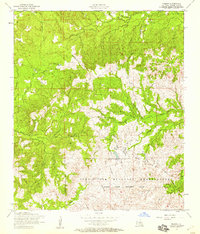
1954 Map of Peason
USGS Topo · Published 1958About this map
Peason Ridge and the northern reaches of the Fort Polk Military Reservation dominate this mid-century landscape in Sabine Parish. The transition from timber and small-scale agriculture to military utility is evident in the Peason Ridge Artillery Range and the networks of a Dismantled Railroad snaking through the hills. Small communities like Peason and Corleyville remain focal points for local history, centered around landmarks such as Peason Church, Gentry Church, and the Peason Fire Tower.
Find a feature on this map
26 named features on this map. Tap any name to fly to it.
Don’t see what you’re looking for? This feature index may not catch every label — zoom into the map to look around manually.
Map Details
Editions of this 1954 Peason Map
3 editions found
Other maps of this area

1937 · Bellwood
USGS Topo · 1:31,680

1942 · Many
USGS Topo · 1:62,500

1942 · Florien
USGS Topo · 1:62,500

1942 · Kisatchie
USGS Topo · 1:62,500

1943 · Many
USGS Topo · 1:62,500

1943 · Kisatchie
USGS Topo · 1:62,500

1943 · Provencal
USGS Topo · 1:62,500

1944 · Florien
USGS Topo · 1:62,500

1945 · Provencal
USGS Topo · 1:62,500

1953 · Alexandria
USGS Topo · 1:250,000