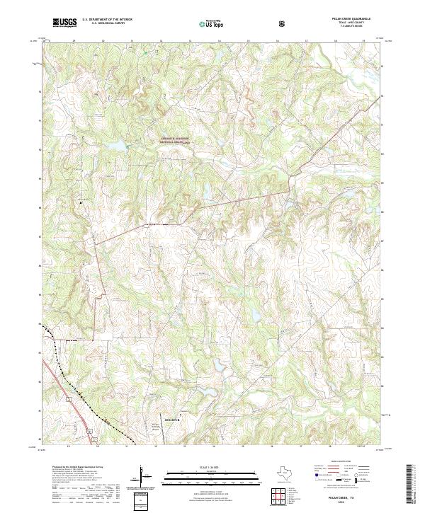
2022 Map of Pecan Creek
USGS Topo · Published 2022About this map
Decatur and its surrounding countryside in Wise County are defined by a complex network of waterways and extensive conservation lands. Much of the northern terrain is occupied by the Lyndon B. Johnson National Grassland, a sprawling protected landscape characterized by intermittent drainage into Black Cr and Denton Cr. The southern portion of the area shows the interface between the growing settlement of Decatur and its rural outskirts, featuring the Decatur Municipal Airport and the local country club. The road network here follows historical routes, including Old Decatur Rd and Old Greenwood Rd, which skirt the numerous tributaries like Catlett Cr and Pecan Cr. For genealogists and local historians, the map provides precise locations for long-standing burial sites such as Oaklawn Cem and Flat Rock Cem, positioned near the winding creek beds that shaped early land holdings.
Find a feature on this map
64 named features on this map. Tap any name to fly to it.
Don’t see what you’re looking for? This feature index may not catch every label — zoom into the map to look around manually.
Map Details
Editions of this 2022 Pecan Creek Map
This is the sole edition of this map. No revisions or reprints were ever made.
Other maps of this area

1930 · Boyd
USGS Topo · 1:62,500

1954 · Sherman
USGS Topo · 1:250,000

1958 · Sherman
USGS Topo · 1:250,000

1960 · Bridgeport East
USGS Topo · 1:24,000

1960 · Decatur
USGS Topo · 1:24,000

1960 · Bluett
USGS Topo · 1:24,000

1961 · Pecan Creek
USGS Topo · 1:24,000

1961 · Alvord
USGS Topo · 1:24,000

1961 · New Harp
USGS Topo · 1:24,000

1961 · Slidell
USGS Topo · 1:24,000