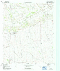
1964 Map of Pecan Gap
USGS Topo · Published 1992About this map
The North Sulphur River carves through the landscape of the Texas blackland prairies, defining the borders where Delta, Lamar, Fannin, and Hunt counties meet. This mid-1960s survey reveals a rural society structured around small settlements and family burial grounds, such as Bledsoe Cem and Waller Cem. The town of Pecan Gap serves as a primary hub, while smaller named locales like Ben Franklin and the evocatively named Jot Em Down punctuate the agricultural grid. The drainage patterns of Johns Creek and Doctors Creek illustrate the natural topography before modern large-scale water management changed the region's hydrology. Genealogists will find significant value in the distribution of rural cemeteries like Baptist Hill Cem and Antioch Cem, which often represent the last remaining markers of early community centers like Antioch and Rattan.
Find a feature on this map
31 named features on this map. Tap any name to fly to it.
Don’t see what you’re looking for? This feature index may not catch every label — zoom into the map to look around manually.
Map Details
Editions of this 1964 Pecan Gap Map
2 editions found

Other maps of this area

1903 · Paris
USGS Topo · 1:125,000

1947 · Honey Grove
USGS Topo · 1:62,500

1948 · Paris
USGS Topo · 1:62,500

1949 · Honey Grove
USGS Topo · 1:62,500

1949 · Paris
USGS Topo · 1:62,500

1953 · Texarkana
USGS Topo · 1:250,000

1956 · Texarkana
USGS Topo · 1:250,000

1964 · Klondike
USGS Topo · 1:24,000

1964 · Commerce North
USGS Topo · 1:24,000

1964 · Cooper North
USGS Topo · 1:24,000