
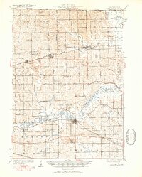
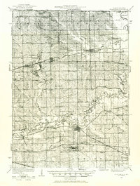
1932 Map of Pecatonica
USGS Topo · Published 1932About this map
The Pecatonica River winds through this agricultural landscape, forming the geographic heart of a region defined by its fertile valleys and early-twentieth-century rail network. In 1932, the towns of Durand and Pecatonica served as primary hubs, connected to smaller communities like Davis and Rock City by the Chicago Milwaukee St Paul and Pacific and the Chicago and North Western railroads.
Find a feature on this map
85 named features on this map. Tap any name to fly to it.
Don’t see what you’re looking for? This feature index may not catch every label — zoom into the map to look around manually.
Map Details
Editions of this 1932 Pecatonica Map
3 editions found
Other maps of this area

1891 · Janesville
USGS Topo · 1:62,500

1893 · Janesville
USGS Topo · 1:62,500

1893 · Brodhead
USGS Topo · 1:62,500

1917 · Kings
USGS Topo · 1:62,500

1918 · Rockford
USGS Topo · 1:62,500

1918 · Kings
USGS Topo · 1:62,500

1920 · Monroe
USGS Topo · 1:62,500

1922 · Monroe
USGS Topo · 1:62,500

1922 · Oregon
USGS Topo · 1:62,500

1924 · Oregon
USGS Topo · 1:62,500