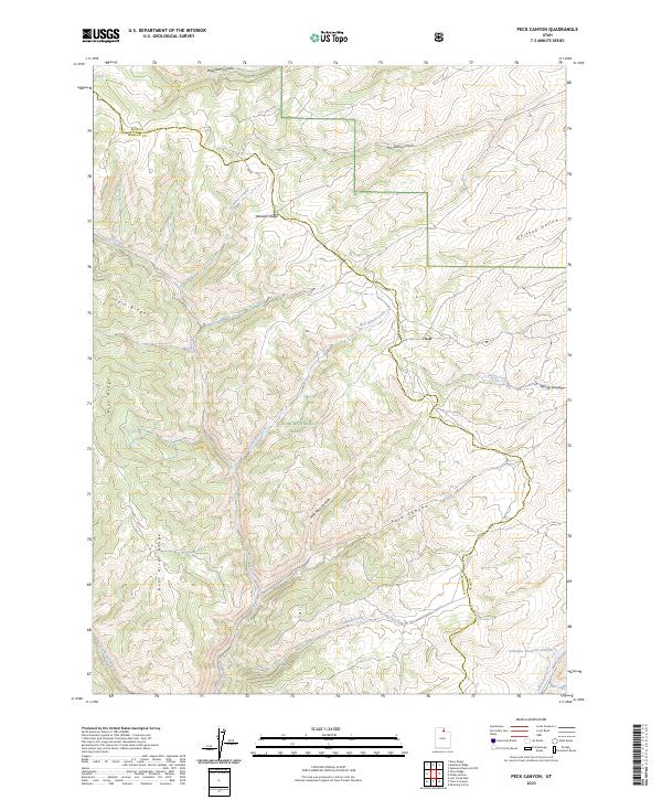
2023 Map of Peck Canyon
USGS Topo · Published 2023About this map
Wasatch Ridge serves as a dominant topographical spine across this landscape, dividing complex drainages that define the border between Rich and Morgan counties. Within the Cache National Forest, the terrain is marked by a network of seasonal and perennial watercourses including Bull Nelson Creek and Freestone Creek, which carve deep canyons into the high country. The map documents the intricate hydrology of the Bear River Range foothills, where livestock management is evidenced by landmarks such as Saleratus Reservoir Number 3. Diverse ridge systems like Condie Ridge and Blue Ridge suggest the physical barriers that have long influenced movement through these northern Utah highlands. The inclusion of Sawmill Creek points toward the early resource extraction history of the area, while the many named canyons such as Peck Canyon and Meachum Canyon provide specific geographical markers for modern land use and historical study.
Find a feature on this map
20 named features on this map. Tap any name to fly to it.
Don’t see what you’re looking for? This feature index may not catch every label — zoom into the map to look around manually.
Map Details
Editions of this 2023 Peck Canyon Map
This is the sole edition of this map. No revisions or reprints were ever made.
Other maps of this area

1954 · Ogden
USGS Topo · 1:250,000

1958 · Ogden
USGS Topo · 1:250,000

1960 · Ogden
USGS Topo · 1:250,000

1964 · Lost Creek Dam
USGS Topo · 1:24,000

1964 · Francis Canyon
USGS Topo · 1:24,000

1968 · Horse Ridge
USGS Topo · 1:24,000

1968 · Dairy Ridge
USGS Topo · 1:24,000

1968 · Shearing Corral
USGS Topo · 1:24,000

1968 · Mc Kay Hollow
USGS Topo · 1:24,000

1968 · Meachum Ridge
USGS Topo · 1:24,000