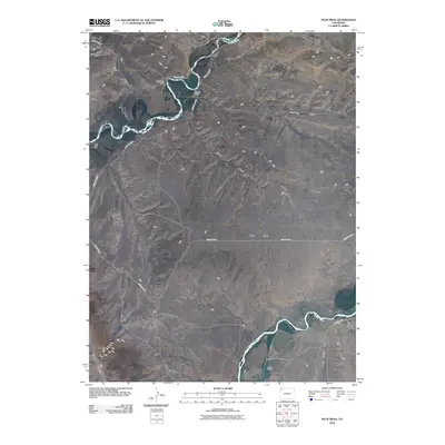
2010 Map of Peck Mesa
USGS Topo · Published 2010About this map
Peck Mesa and the surrounding high desert of Moffat County are defined by the convergence of the Little Snake River and the Yampa River. The landscape is etched by a complex drainage network, including Sand Wash, Three C Wash, and Simsberry Draw, which channel seasonal runoff toward the primary river systems. Human presence is represented by established agricultural operations such as Sand Wash Ranch, Two Bar Ranch, and Sevens Ranch, situated near reliable water sources or along the county road system. In the southwest, the rise of Cross Mountain provides a significant vertical contrast to the mesa. This map documents the persistent ranching culture and hydrological features of Northwestern Colorado at the end of the first decade of the 21st century.
Find a feature on this map
20 named features on this map. Tap any name to fly to it.
Don’t see what you’re looking for? This feature index may not catch every label — zoom into the map to look around manually.
Map Details
Editions of this 2010 Peck Mesa Map
This is the sole edition of this map. No revisions or reprints were ever made.
Other maps of this area

1907 · White River
USGS Topo · 1:125,000

1910 · White River
USGS Topo · 1:125,000

1954 · Vernal
USGS Topo · 1:250,000

1958 · Vernal
USGS Topo · 1:250,000

1958 · Maybell
USGS Topo · 1:62,500

1958 · Citadel Plateau
USGS Topo · 1:62,500

1960 · Vernal
USGS Topo · 1:250,000

1960 · Elk Springs
USGS Topo · 1:62,500

1960 · Lone Mountain
USGS Topo · 1:62,500
1979 · Rangely
USGS Topo · 1:100,000