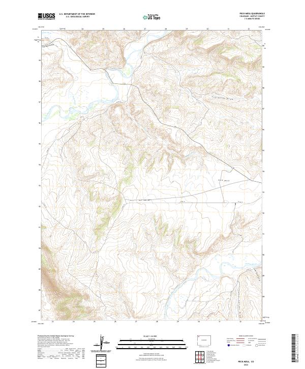
2022 Map of Peck Mesa
USGS Topo · Published 2022About this map
Peck Mesa rises as a prominent landmark in this corner of Moffat County, where the high desert plateau meets the winding course of the Little Snake River and the Yampa River. The landscape is defined by a series of significant drainages, including Simsberry Draw and Sand Wash, which carve through the arid terrain. While the area is sparsely settled, the network of county roads like Co RD 10 and Co RD 215 provides access across the township and range lines of the public land survey system.
Find a feature on this map
23 named features on this map. Tap any name to fly to it.
Don’t see what you’re looking for? This feature index may not catch every label — zoom into the map to look around manually.
Map Details
Editions of this 2022 Peck Mesa Map
This is the sole edition of this map. No revisions or reprints were ever made.
Other maps of this area

1907 · White River
USGS Topo · 1:125,000

1910 · White River
USGS Topo · 1:125,000

1954 · Vernal
USGS Topo · 1:250,000

1958 · Vernal
USGS Topo · 1:250,000

1958 · Maybell
USGS Topo · 1:62,500

1958 · Citadel Plateau
USGS Topo · 1:62,500

1960 · Vernal
USGS Topo · 1:250,000

1960 · Elk Springs
USGS Topo · 1:62,500

1960 · Lone Mountain
USGS Topo · 1:62,500
1979 · Rangely
USGS Topo · 1:100,000