
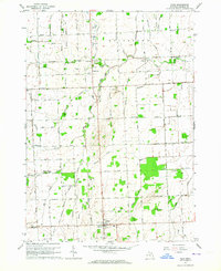
1963 Map of Peck
USGS Topo · Published 1964About this map
Agricultural drainage and the legacy of the steam era define this Sanilac County landscape in the early 1960s. The village of Peck serves as a local hub, featuring a prominent Water Tank and central street grid. The surrounding townships of Watertown and Elk are divided by a precise network of section-line roads, including Townline Road and Watertown Line Road. This rural infrastructure is punctuated by community landmarks such as Lynch Sch, Zion Cem, and the Latter Day Saints Ch.
Find a feature on this map
57 named features on this map. Tap any name to fly to it.
Don’t see what you’re looking for? This feature index may not catch every label — zoom into the map to look around manually.
Map Details
Editions of this 1963 Peck Map
2 editions found
Other maps of this area

1954 · Flint
USGS Topo · 1:250,000

1958 · Flint
USGS Topo · 1:250,000

1961 · Brown City
USGS Topo · 1:24,000

1961 · Roseburg
USGS Topo · 1:24,000

1961 · Yale
USGS Topo · 1:24,000

1963 · Snover
USGS Topo · 1:24,000

1963 · Sandusky
USGS Topo · 1:24,000

1963 · Juhl
USGS Topo · 1:24,000

1963 · Applegate
USGS Topo · 1:24,000
1963 · Carsonville
USGS Topo · 1:24,000