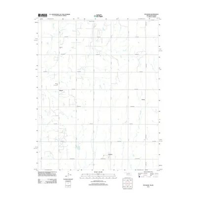
2012 Map of Peckham
USGS Topo · Published 2012About this map
Dilworth and its surrounding oil and gas infrastructure characterize this northern Oklahoma landscape just south of the Kansas border. The Dilworth Oil and Gas Field and Murphy Oil Field point to the area's industrial legacy, while a strict grid of section-line roads like W Indian Rd and W Peckham Rd organizes the rural landscape. Near the settlement of Peckham, the topography is defined by small watercourses including Lost Cr and Duck Cr, with Wentz Lake providing a rare catchment in the southern portion of the quadrangle. For genealogists and local historians, Plainview Cem stands as a primary landmark in the northwest near E Bitter Cr. The proximity of small communities like Bender to these varied creek systems suggests a history of agricultural settlement deeply tied to the local hydrology of the southern plains.
Find a feature on this map
28 named features on this map. Tap any name to fly to it.
Don’t see what you’re looking for? This feature index may not catch every label — zoom into the map to look around manually.
Map Details
Editions of this 2012 Peckham Map
This is the sole edition of this map. No revisions or reprints were ever made.
Other maps of this area

1890 · Wellington
USGS Topo · 1:125,000

1955 · Wichita
USGS Topo · 1:250,000

1955 · Enid
USGS Topo · 1:250,000

1958 · Enid
USGS Topo · 1:250,000

1958 · Wichita
USGS Topo · 1:250,000

1965 · Portland
USGS Topo · 1:24,000

1965 · Arkansas City
USGS Topo · 1:24,000

1965 · Geuda Springs
USGS Topo · 1:24,000

1967 · Braman
USGS Topo · 1:24,000
1968 · Newkirk
USGS Topo · 1:24,000