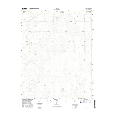
2016 Map of Peckham
USGS Topo · Published 2016About this map
Peckham and the surrounding agricultural landscapes of northern Kay County are defined by a grid of rural roads and the undulating drainages that feed into the Arkansas River basin. This 2016 survey illustrates a region where local geography is marked by small settlements like Dilworth and Bender, which emerged near the Kansas-Oklahoma state line. The terrain is deeply carved by a network of seasonal and perennial streams, including Middle Bitter Cr, Spring Cr, and Scatter Cr, which drain the area's many low hills.
Find a feature on this map
26 named features on this map. Tap any name to fly to it.
Don’t see what you’re looking for? This feature index may not catch every label — zoom into the map to look around manually.
Map Details
Editions of this 2016 Peckham Map
This is the sole edition of this map. No revisions or reprints were ever made.
Other maps of this area

1890 · Wellington
USGS Topo · 1:125,000

1955 · Wichita
USGS Topo · 1:250,000

1955 · Enid
USGS Topo · 1:250,000

1958 · Enid
USGS Topo · 1:250,000

1958 · Wichita
USGS Topo · 1:250,000

1965 · Portland
USGS Topo · 1:24,000

1965 · Arkansas City
USGS Topo · 1:24,000

1965 · Geuda Springs
USGS Topo · 1:24,000

1967 · Braman
USGS Topo · 1:24,000
1968 · Newkirk
USGS Topo · 1:24,000