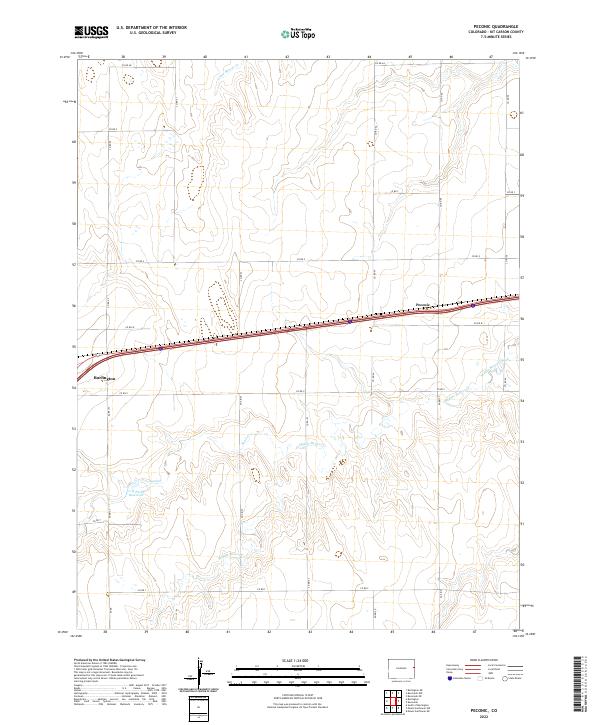
2022 Map of Peconic
USGS Topo · Published 2022About this map
Peconic and the eastern edge of Burlington anchor this section of the High Plains, where the landscape is defined by the intermittent drainage patterns of the Colorado prairie. The terrain is marked by the distinct draws of Little Beaver Cr, Sand Cr, and Middle Beaver Cr, which cut through the agricultural grid. A notable local landmark, the C H Parks Reservoir, sits south of the main thoroughfare, reflecting the critical role of water management in this arid region. The map captures the rectilinear organization of Kit Carson County, delineated by an extensive network of county roads from Co RD Aa to Co RD S. This 2022 survey illustrates the modern intersection of interstate transit and traditional rural section lines, preserving the names of local water features and family-linked sites that have shaped the county's ranching and farming identity for generations.
Find a feature on this map
25 named features on this map. Tap any name to fly to it.
Don’t see what you’re looking for? This feature index may not catch every label — zoom into the map to look around manually.
Map Details
Editions of this 2022 Peconic Map
This is the sole edition of this map. No revisions or reprints were ever made.
Other maps of this area

1954 · Limon
USGS Topo · 1:250,000

1957 · Limon
USGS Topo · 1:250,000

1958 · Limon
USGS Topo · 1:250,000

1969 · Kanorado NE
USGS Topo · 1:24,000

1969 · Burlington
USGS Topo · 1:24,000

1969 · Mount Sunflower NW
USGS Topo · 1:24,000
1969 · Mount Sunflower NE
USGS Topo · 1:24,000

1969 · Peconic
USGS Topo · 1:24,000

1969 · Kanorado NW
USGS Topo · 1:24,000
1969 · Burlington NE
USGS Topo · 1:24,000