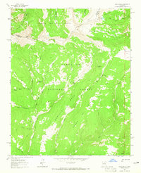
1963 Map of Pecos Falls
USGS Topo · Published 1965About this map
Chimayosos Peak and the high alpine ridges of the Sangre de Cristo Mountains define this 1963 survey, where the Carson National Forest meets the Santa Fe National Forest. The landscape is dominated by the headwaters of major drainages, including the Rio Pecos and Rio Mora, which carve through deep canyons and over Pecos Falls. The presence of Beatty Cabin and Smith Cabin along the rivers highlights the area's history as a remote backcountry destination for forest rangers and early recreationists.
Find a feature on this map
31 named features on this map. Tap any name to fly to it.
Don’t see what you’re looking for? This feature index may not catch every label — zoom into the map to look around manually.
Map Details
Editions of this 1963 Pecos Falls Map
2 editions found
Other maps of this area

1889 · Las Vegas
USGS Topo · 1:125,000

1889 · Santa Fe
USGS Topo · 1:125,000

1891 · Las Vegas
USGS Topo · 1:125,000

1893 · Las Vegas
USGS Topo · 1:125,000

1894 · Santa Fe
USGS Topo · 1:125,000

1954 · Santa Fe
USGS Topo · 1:250,000

1954 · Raton
USGS Topo · 1:250,000

1958 · Raton
USGS Topo · 1:250,000

1958 · Santa Fe
USGS Topo · 1:250,000
1961 · Cowles
USGS Topo · 1:24,000