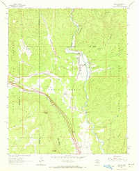
1961 Map of Pecos
USGS Topo · Published 1972About this map
Pecos State Monument Ruins and the historic Pecos Pueblo grant lands anchor this 1961 survey, where the Pecos River carves through a landscape shaped by ancient habitation and modern industry. The settlement of Pecos and East Pecos serve as central hubs, connected by the steady presence of the Atchison Topeka and Santa Fe railroad corridor. Notable institutional landmarks like the Benedictine Monastery and the Lisboa Springs Fish Hatchery reflect the area's diverse land use, while the Fairview Lode Mine and various tailings ponds point to the region's extractive history.
Find a feature on this map
34 named features on this map. Tap any name to fly to it.
Don’t see what you’re looking for? This feature index may not catch every label — zoom into the map to look around manually.
Map Details
Editions of this 1961 Pecos Map
2 editions found
Other maps of this area

1889 · Santa Fe
USGS Topo · 1:125,000

1894 · Santa Fe
USGS Topo · 1:125,000

1894 · Lamy
USGS Topo · 1:125,000

1953 · Glorieta
USGS Topo · 1:24,000

1953 · Mc Clure Reservoir
USGS Topo · 1:24,000

1954 · Santa Fe
USGS Topo · 1:250,000

1958 · Santa Fe
USGS Topo · 1:250,000

1961 · Honey Boy Ranch
USGS Topo · 1:24,000

1961 · Rosilla Peak
USGS Topo · 1:24,000
1961 · Pecos
USGS Topo · 1:24,000