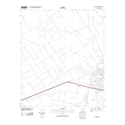
2010 Map of Pecos West
USGS Topo · Published 2010About this map
Pecos anchors the eastern edge of this Reeves County landscape, showing the city's westward expansion at the start of the 2010s. The map highlights a transition from the urban grid of the county seat to the expansive ranching and oil-patch infrastructure defined by long, straight thoroughfares like Ranch Rd 2119 and Chappell Rd. A cluster of aviation and local services is centered around the Pecos Municipal Airport, while the smaller settlements of Mann and Locker appear as distinct points of interest south of the city core. Genealogical value is found in the detailed locations of Fairview Cemetery and Mount Evergreen Cemetery, which serve as significant landmarks for the community. The infrastructure reflects a desert economy built on transportation, with the intersection of state ranch roads and a dense network of county routes like Co Rd 418 providing access to the surrounding arid terrain.
Find a feature on this map
40 named features on this map. Tap any name to fly to it.
Don’t see what you’re looking for? This feature index may not catch every label — zoom into the map to look around manually.
Map Details
Editions of this 2010 Pecos West Map
This is the sole edition of this map. No revisions or reprints were ever made.
Other maps of this area

1921 · Toyah
USGS Topo · 1:125,000

1931 · Barstow
USGS Topo · 1:125,000

1954 · Pecos
USGS Topo · 1:250,000

1957 · Pecos
USGS Topo · 1:250,000

1961 · Soda Lake
USGS Topo · 1:24,000

1961 · Sand Lake
USGS Topo · 1:24,000

1963 · Pecos East
USGS Topo · 1:24,000

1963 · Toyah Lake
USGS Topo · 1:24,000

1968 · Mentone SW
USGS Topo · 1:24,000

1970 · Hermosa SW
USGS Topo · 1:24,000