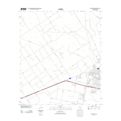
2012 Map of Pecos West
USGS Topo · Published 2012About this map
Pecos Municipal Airport anchors the southeastern portion of this Reeves County landscape, reflecting the modern infrastructure of this West Texas hub in the early twenty-first century. The grid pattern of the western city limits is clearly defined, featuring residential and commercial streets such as W Washington St and N Alamo St. This detailed survey documents the intersection of heavy transit and local history, capturing the location of Fairview Cem and Mt Evergreen Cem alongside the westward expansion of the town. Outside the municipal core, the land is etched with a network of rural routes including Ranch Road 2119 and Hog Rd, while small named locales like Mann and Locker indicate pockets of settlement along the arterial roads. The geography is characterized by the structured transition from an organized urban center to a wide-reaching grid of county roads.
Find a feature on this map
76 named features on this map. Tap any name to fly to it.
Don’t see what you’re looking for? This feature index may not catch every label — zoom into the map to look around manually.
Map Details
Editions of this 2012 Pecos West Map
This is the sole edition of this map. No revisions or reprints were ever made.
Other maps of this area

1921 · Toyah
USGS Topo · 1:125,000

1931 · Barstow
USGS Topo · 1:125,000

1954 · Pecos
USGS Topo · 1:250,000

1957 · Pecos
USGS Topo · 1:250,000

1961 · Soda Lake
USGS Topo · 1:24,000

1961 · Sand Lake
USGS Topo · 1:24,000

1963 · Pecos East
USGS Topo · 1:24,000

1963 · Toyah Lake
USGS Topo · 1:24,000

1968 · Mentone SW
USGS Topo · 1:24,000

1970 · Hermosa SW
USGS Topo · 1:24,000