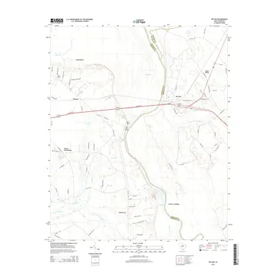
2014 Map of Pee Dee
USGS Topo · Published 2014About this map
The Great Pee Dee River serves as the dominant natural boundary on this 2014 survey, winding through the South Carolina lowlands where Florence, Dillon, and Marion counties meet. The landscape is a network of slow-moving water and low-lying drainages like Muddy Gut and Jeffries Cr. In the western portion of the map, the settlements of Jamestown and Winona are established near family-history landmarks such as Moody Cem and the Jamestown Cemetery.
Find a feature on this map
79 named features on this map. Tap any name to fly to it.
Don’t see what you’re looking for? This feature index may not catch every label — zoom into the map to look around manually.
Map Details
Editions of this 2014 Pee Dee Map
This is the sole edition of this map. No revisions or reprints were ever made.
Other maps of this area

1940 · Florence East
USGS Topo · 1:62,500

1943 · Gum Swamp
USGS Topo · 1:62,500

1945 · Florence East
USGS Topo · 1:62,500

1947 · Friendship
USGS Topo · 1:24,000

1947 · Marion
USGS Topo · 1:24,000

1953 · Florence
USGS Topo · 1:250,000

1954 · Florence
USGS Topo · 1:250,000

1960 · Latta
USGS Topo · 1:24,000
1972 · Oak Grove
USGS Topo · 1:24,000
1972 · Witherspoon Island
USGS Topo · 1:24,000