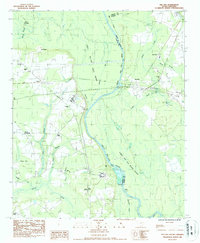
1986 Map of Pee Dee
USGS Topo · Published 1987About this map
The Great Pee Dee River and its surrounding wetlands define the landscape where Florence, Marion, and Dillon counties meet. This 1978 field-checked map records a rural network of small communities and family churches along the river corridor, including Winona, Jamestown, and Blue Brick. The vast Great Pee Dee River Swamp dominates the eastern half of the sheet, intersected by Tobys Creek and the CSX railroad line. Industrial infrastructure such as a Water Intake and a Pump Sta along the riverbanks suggests the area's role in local water management, while names like Parker Crossroads and Carter Landing point to the historically significant transport and gathering points that once linked these riverine settlements.
Find a feature on this map
41 named features on this map. Tap any name to fly to it.
Don’t see what you’re looking for? This feature index may not catch every label — zoom into the map to look around manually.
Map Details
Editions of this 1986 Pee Dee Map
This is the sole edition of this map. No revisions or reprints were ever made.
Other maps of this area

1940 · Florence East
USGS Topo · 1:62,500

1943 · Gum Swamp
USGS Topo · 1:62,500

1945 · Florence East
USGS Topo · 1:62,500

1947 · Friendship
USGS Topo · 1:24,000

1947 · Marion
USGS Topo · 1:24,000

1953 · Florence
USGS Topo · 1:250,000

1954 · Florence
USGS Topo · 1:250,000

1960 · Latta
USGS Topo · 1:24,000
1972 · Oak Grove
USGS Topo · 1:24,000
1972 · Witherspoon Island
USGS Topo · 1:24,000