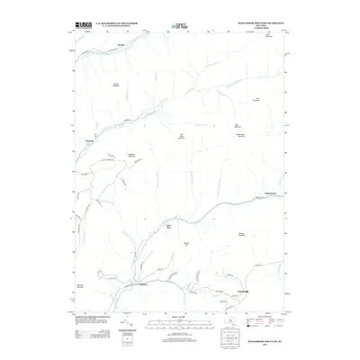
2013 Map of Peekamoose Mountain
USGS Topo · Published 2013About this map
Slide Mountain and Peekamoose Mountain anchor this detailed study of the High Peaks region, where the headwaters of the Neversink and Rondout systems diverge. Small hamlets like Denning and Sundown sit along the narrow valley floors, connected by a network of winding roads including Frost Valley Rd and Peekamoose Rd. The map illustrates a landscape defined by significant elevation changes, with peaks such as Lone Mountain and Table Mountain towering over the drainages of Biscuit Brook and Buttermilk Falls Brook. In the southern reaches, Greenville marks a point of lower relief before the terrain climbs again toward Samson Mountain. This survey is particularly useful for identifying specific mountain access points and the historic placement of isolated mountain communities alongside the W Br Neversink River.
Find a feature on this map
64 named features on this map. Tap any name to fly to it.
Don’t see what you’re looking for? This feature index may not catch every label — zoom into the map to look around manually.
Map Details
Editions of this 2013 Peekamoose Mountain Map
This is the sole edition of this map. No revisions or reprints were ever made.
Other maps of this area

1900 · Phoenicia
USGS Topo · 1:62,500

1901 · Margaretville
USGS Topo · 1:62,500

1903 · Phoenicia
USGS Topo · 1:62,500

1903 · Slide Mountain
USGS Topo · 1:62,500

1904 · Margaretville
USGS Topo · 1:62,500

1905 · Slide Mountain
USGS Topo · 1:62,500

1910 · Neversink
USGS Topo · 1:62,500

1942 · West Shokan
USGS Topo · 1:24,000

1942 · Neversink
USGS Topo · 1:62,500

1942 · Lackawack
USGS Topo · 1:24,000