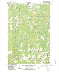
1984 Map of Peeksville
USGS Topo · Published 1984About this map
The East Fork Chippewa River winds through this Ashland County landscape, which by the early 1980s was defined by a mix of forestry and rural infrastructure. The small settlement of Peeksville sits centrally, while further south, the St Cecelia Cem and a nearby Water Tower mark the outskirts of Butternut. The land is characterized by numerous glacial features, including Camp Four Lake, Slim Lake, and Bullhead Lake.
Find a feature on this map
52 named features on this map. Tap any name to fly to it.
Don’t see what you’re looking for? This feature index may not catch every label — zoom into the map to look around manually.
Map Details
Editions of this 1984 Peeksville Map
This is the sole edition of this map. No revisions or reprints were ever made.
Other maps of this area

1940 · Butternut
USGS Topo · 1:48,000

1941 · Park Falls
USGS Topo · 1:48,000

1941 · Kennedy
USGS Topo · 1:48,000

1942 · Glidden
USGS Topo · 1:48,000

1943 · Park Falls
USGS Topo · 1:48,000

1945 · Kennedy
USGS Topo · 1:48,000

1945 · Glidden
USGS Topo · 1:48,000

1947 · Park Falls
USGS Topo · 1:48,000

1947 · Butternut
USGS Topo · 1:48,000

1950 · Butternut
USGS Topo · 1:48,000