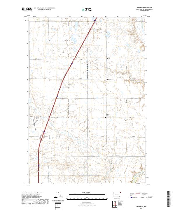
2021 Map of Peever NW
USGS Topo · Published 2021About this map
The Little Minnesota River meanders across this rural corner of Roberts County, carving a subtle path through a landscape defined by organized township grids and sprawling agricultural fields. The map documents a significant intersection of local heritage and modern infrastructure, where the Sisseton Municipal Airport sits alongside long-established rural landmarks. The drainage of Jim Cr and the presence of Cottonwood Slough reveal the natural hydrology that shaped early settlement patterns in this part of South Dakota.
Find a feature on this map
36 named features on this map. Tap any name to fly to it.
Don’t see what you’re looking for? This feature index may not catch every label — zoom into the map to look around manually.
Map Details
Editions of this 2021 Peever NW Map
This is the sole edition of this map. No revisions or reprints were ever made.
Other maps of this area

1916 · Peever
USGS Topo · 1:62,500

1917 · New Effington
USGS Topo · 1:62,500

1918 · Peever
USGS Topo · 1:62,500

1953 · Milbank
USGS Topo · 1:250,000

1958 · Milbank
USGS Topo · 1:250,000

1964 · Claire City
USGS Topo · 1:24,000

1970 · Sisseton
USGS Topo · 1:24,000

1970 · Goodwill
USGS Topo · 1:24,000

1971 · Browns Valley
USGS Topo · 1:24,000
1971 · Peever
USGS Topo · 1:24,000
Featured Places
- Old Agency District, SD
- Heipa District
- Long Hollow District, SD
- Lake Traverse District, SD
- Roberts County, SD