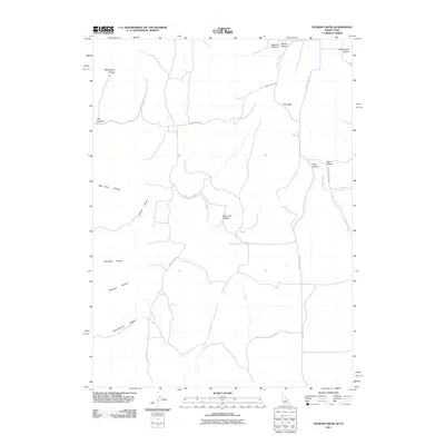
2011 Map of Pegram Creek
USGS Topo · Published 2011About this map
Pegram Creek flows through the high country along the Idaho-Utah border, defining a landscape of deep canyons and named hollows. The rugged drainage system of the Bear Lake Plateau is marked by numerous family and descriptive landmarks, such as Transtrum Hollow and Bee Hunt Hollow, indicating a history of ranching and land use in this high-altitude terrain. A network of rural routes, including Poverty Flat Rd and Indian Creek Rd, provides access across the ridgelines from Mahogany Ridge in the northwest to the canyon bottoms. This 2011 survey captures the area's essential geography, where water sources like Spring Hollow and Horse Creek dictated the placement of remote access points like Nunberg Ranch Rd.
Find a feature on this map
21 named features on this map. Tap any name to fly to it.
Don’t see what you’re looking for? This feature index may not catch every label — zoom into the map to look around manually.
Map Details
Editions of this 2011 Pegram Creek Map
This is the sole edition of this map. No revisions or reprints were ever made.
Other maps of this area

1909 · Montpelier
USGS Topo · 1:125,000

1911 · Montpelier
USGS Topo · 1:125,000

1912 · Randolph
USGS Topo · 1:125,000

1954 · Ogden
USGS Topo · 1:250,000

1955 · Preston
USGS Topo · 1:250,000

1958 · Ogden
USGS Topo · 1:250,000

1958 · Preston
USGS Topo · 1:250,000

1960 · Ogden
USGS Topo · 1:250,000

1962 · Preston
USGS Topo · 1:250,000

1967 · Dingle
USGS Topo · 1:24,000