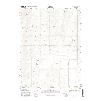
2017 Map of Pegram Creek
USGS Topo · Published 2017About this map
Idaho and Utah meet in this rugged high-altitude corridor where the state line bisects the landscape between Bear Lake County and Rich County. The topography is defined by a dense network of drainages and ridges, including the prominent Mahogany Ridge and Pine Spring Ridge in the northwest. Movement through this terrain is dictated by the natural corridors of the hollows, with seasonal watercourses like Indian Cr and Pegram Creek carving deep paths through the limestone and soil. A sparse network of ranch roads, such as Indian Creek Rd and Humburg Ranch Rd, provides the only access to the interior. The map reveals the persistence of traditional land use and naming conventions, with family and descriptive monikers identifying landmarks like Peterson Hollow, Bee Hunt Hollow, and the narrow Pine Gap.
Find a feature on this map
27 named features on this map. Tap any name to fly to it.
Don’t see what you’re looking for? This feature index may not catch every label — zoom into the map to look around manually.
Map Details
Editions of this 2017 Pegram Creek Map
This is the sole edition of this map. No revisions or reprints were ever made.
Other maps of this area

1909 · Montpelier
USGS Topo · 1:125,000

1911 · Montpelier
USGS Topo · 1:125,000

1912 · Randolph
USGS Topo · 1:125,000

1954 · Ogden
USGS Topo · 1:250,000

1955 · Preston
USGS Topo · 1:250,000

1958 · Ogden
USGS Topo · 1:250,000

1958 · Preston
USGS Topo · 1:250,000

1960 · Ogden
USGS Topo · 1:250,000

1962 · Preston
USGS Topo · 1:250,000

1967 · Dingle
USGS Topo · 1:24,000