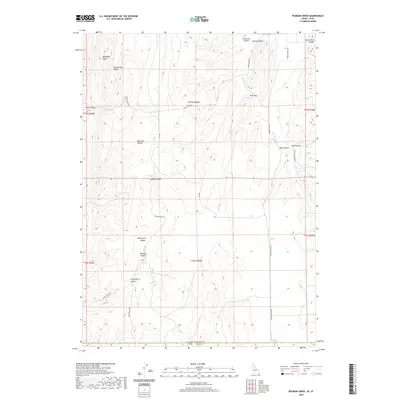
2020 Map of Pegram Creek
USGS Topo · Published 2020About this map
Mahogany Ridge and Pine Spring Ridge dominate the northwestern corner of this landscape, which straddles the high-country border between Rich County, Utah, and Bear Lake County, Idaho. The terrain is characterized by a dense network of drainages and named depressions, including Bee Hunt Hollow, Transtrum Hollow, and Swine Bend Hollow. These features suggest a history of seasonal grazing and water management, connected by a rudimentary grid of ranching roads like Indian Creek Rd and Poverty Flats Rd. The movement of water is central to the topography here, with Indian Cr and Pegram Cr carving paths through the elevated plateaus. Small-scale landmarks such as Pine Gap and Dry Canyon provide specific orientation points for those tracing historical land use or family property boundaries in this high-altitude ranching corridor.
Find a feature on this map
29 named features on this map. Tap any name to fly to it.
Don’t see what you’re looking for? This feature index may not catch every label — zoom into the map to look around manually.
Map Details
Editions of this 2020 Pegram Creek Map
This is the sole edition of this map. No revisions or reprints were ever made.
Other maps of this area

1909 · Montpelier
USGS Topo · 1:125,000

1911 · Montpelier
USGS Topo · 1:125,000

1912 · Randolph
USGS Topo · 1:125,000

1954 · Ogden
USGS Topo · 1:250,000

1955 · Preston
USGS Topo · 1:250,000

1958 · Ogden
USGS Topo · 1:250,000

1958 · Preston
USGS Topo · 1:250,000

1960 · Ogden
USGS Topo · 1:250,000

1962 · Preston
USGS Topo · 1:250,000

1967 · Dingle
USGS Topo · 1:24,000