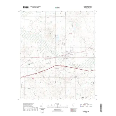
2018 Map of Pelahatchie
USGS Topo · Published 2018About this map
Pelahatchie serves as the focal point of this Rankin County landscape, where the intersection of traditional rail routes and modern thoroughfares like Service Dr shapes the town's layout. Numerous family and community burial grounds, including Pelahatchie Cem, Little Zion Cem, and Eastside Cem, are distributed across the area, providing critical points of reference for genealogical research. The terrain is defined by the winding course of Pelahatchie Creek and its many tributaries such as Ashlog Cr and Eutacutachee Cr, which drain the surrounding Johnson Valley Hills. Small settlements and rural clusters like Gulde and Cross Roads are linked by a network of historic roads, including Old Wire Rd and Old Hwy 80. To the north, Ware Hill rises above the marshy wetlands near County Lake, while Payne Airport sits as a localized landmark west of the main town center.
Find a feature on this map
76 named features on this map. Tap any name to fly to it.
Don’t see what you’re looking for? This feature index may not catch every label — zoom into the map to look around manually.
Map Details
Editions of this 2018 Pelahatchie Map
This is the sole edition of this map. No revisions or reprints were ever made.
Other maps of this area

1922 · Morton
USGS Topo · 1:48,000

1922 · Pelahatchee
USGS Topo · 1:48,000

1924 · Pelahatchee
USGS Topo · 1:62,500

1924 · Morton
USGS Topo · 1:62,500

1950 · Pelahatchie
USGS Topo · 1:62,500

1951 · Morton
USGS Topo · 1:62,500

1952 · Pelahatchie
USGS Topo · 1:62,500

1953 · Meridian
USGS Topo · 1:250,000

1957 · Meridian
USGS Topo · 1:250,000

1965 · Meridian
USGS Topo · 1:250,000