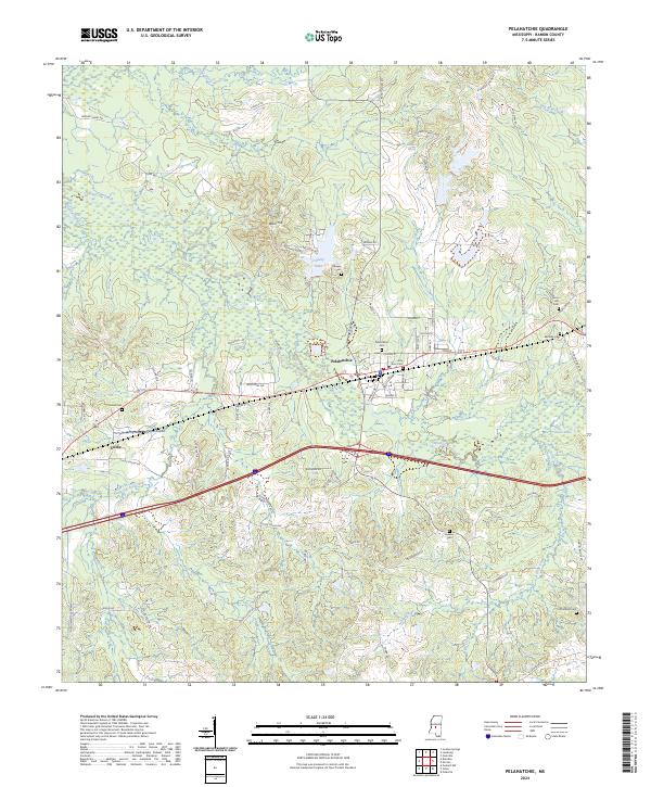
2024 Map of Pelahatchie
USGS Topo · Published 2024About this map
The town of Pelahatchie serves as the central hub of this Rankin County landscape, situated at the intersection of significant rail and road corridors. The surrounding terrain is defined by a complex network of waterways, including Pelahatchie Creek, Eutacutachee Creek, and the smaller Ashlog Creek, which drain the varied topography. The prominence of Ware Hill north of the town center offers a notable vantage point over County Lake, while the local infrastructure is anchored by Payne Airport and the smaller settlement of Gulde to the west. Local genealogy and community history are well-documented through numerous burial sites, such as the Pelahatchie Cem, Little Zion Cem, and Reagan Cem. This modern survey illustrates how traditional landmarks like Mineral Spring and Gum Lake persist alongside industrial development and updated transportation routes, providing a clear record of the area's current geographic character.
Find a feature on this map
84 named features on this map. Tap any name to fly to it.
Don’t see what you’re looking for? This feature index may not catch every label — zoom into the map to look around manually.
Map Details
Editions of this 2024 Pelahatchie Map
This is the sole edition of this map. No revisions or reprints were ever made.
Other maps of this area

1922 · Morton
USGS Topo · 1:48,000

1922 · Pelahatchee
USGS Topo · 1:48,000

1924 · Pelahatchee
USGS Topo · 1:62,500

1924 · Morton
USGS Topo · 1:62,500

1950 · Pelahatchie
USGS Topo · 1:62,500

1951 · Morton
USGS Topo · 1:62,500

1952 · Pelahatchie
USGS Topo · 1:62,500

1953 · Meridian
USGS Topo · 1:250,000

1957 · Meridian
USGS Topo · 1:250,000

1965 · Meridian
USGS Topo · 1:250,000