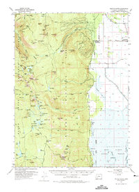
1955 Map of Pelican Butte
USGS Topo · Published 1963About this map
Pelican Butte anchors the southern portion of this high-elevation landscape within the Winema National Forest and Rogue River National Forest. In the mid-1950s, this area was defined by a complex network of forest management and early recreation infrastructure, including the Sevenmile Guard Station and several remote outposts like Solace Camp and Cold Spring Camp. The northern edge transitions toward the Oregon Desert, while the eastern boundary traces the edge of the Upper Klamath National Wildlife Refuge.
Find a feature on this map
104 named features on this map. Tap any name to fly to it.
Don’t see what you’re looking for? This feature index may not catch every label — zoom into the map to look around manually.
Map Details
Editions of this 1955 Pelican Butte Map
3 editions found
Other maps of this area

1889 · Klamath
USGS Topo · 1:250,000

1891 · Ashland
USGS Topo · 1:250,000

1893 · Ashland
USGS Topo · 1:250,000

1894 · Klamath
USGS Topo · 1:250,000

1897 · Ashland
USGS Topo · 1:250,000

1955 · Lake O' Woods
USGS Topo · 1:62,500

1955 · Rustler Peak
USGS Topo · 1:62,500

1955 · Mt. Mc Loughlin
USGS Topo · 1:62,500

1955 · Pelican Butte
USGS Topo · 1:62,500

1955 · Klamath Falls
USGS Topo · 1:250,000