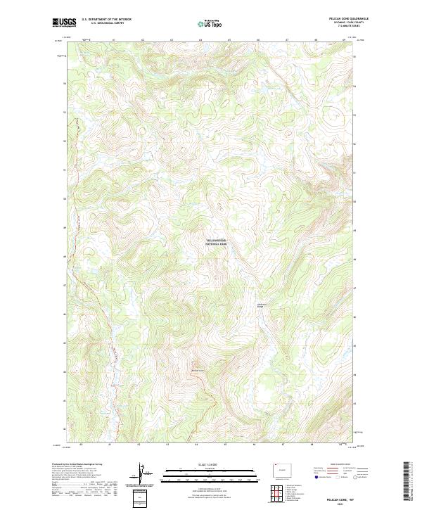
2021 Map of Pelican Cone
USGS Topo · Published 2021About this map
Yellowstone National Park reveals its geothermal and high-elevation character across this portion of the Absaroka Range. The landscape is defined by the thermal features of the Hot Spring Basin Group and the descriptive thermal landmarks of The Mushpots and The Mudkettles, situated near the headwaters of Pelican Cr. At the center of the sheet, Pelican Cone serves as a dominant topographic landmark overlooking a network of drainage systems including Wrong Cr, Raven Cr, and the Mirror Fork. Human presence is minimal, represented primarily by the Pelican Creek Trl which traverses the western edge of the quadrangle. The map documents the wilderness as it appeared in the early 21st century, showing the transition from alpine peaks down to secluded water bodies like Mirror Lake and Ponuntpa Spring.
Find a feature on this map
21 named features on this map. Tap any name to fly to it.
Don’t see what you’re looking for? This feature index may not catch every label — zoom into the map to look around manually.
Map Details
Editions of this 2021 Pelican Cone Map
This is the sole edition of this map. No revisions or reprints were ever made.
Other maps of this area

1886 · Canyon
USGS Topo · 1:125,000

1895 · Canyon
USGS Topo · 1:125,000

1896 · Canyon
USGS Topo · 1:125,000

1901 · Canyon
USGS Topo · 1:125,000

1907 · Canyon
USGS Topo · 1:125,000

1911 · Canyon
USGS Topo · 1:125,000

1955 · Ashton
USGS Topo · 1:250,000

1958 · Ashton
USGS Topo · 1:250,000
1959 · Pelican Cone
USGS Topo · 1:62,500
1959 · Canyon Village
USGS Topo · 1:62,500