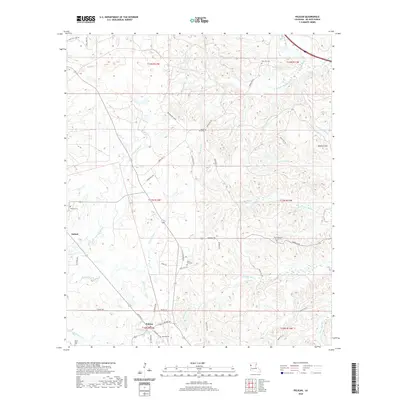
2020 Map of Pelican
USGS Topo · Published 2020About this map
Pelican serves as the primary hub of activity in this part of DeSoto Parish, where a grid of local streets including Cotton St and Commerce St marks the center of the community. The surrounding landscape is defined by an intricate network of waterways, with the meandering courses of Rambin Bayou and Prairie Bayou draining the undulating terrain. Genealogists will find a high density of burial sites across the quadrangle, ranging from the central Pelican Cem and Saint Paul Cem to the outlying Zion Hill Cem and Grove Hill Cem. The settlement of Oxford sits to the west, accompanied by its namesake Oxford Cem, while the eastern portion of the map is dominated by the Dolette Hills. These features collectively illustrate a region established around traditional parish roads and small community congregations, such as the Saint Matthew Church, which remains a focal point for the rural population.
Find a feature on this map
56 named features on this map. Tap any name to fly to it.
Don’t see what you’re looking for? This feature index may not catch every label — zoom into the map to look around manually.
Map Details
Editions of this 2020 Pelican Map
This is the sole edition of this map. No revisions or reprints were ever made.
Other maps of this area

1938 · Chemard Lake
USGS Topo · 1:31,680

1938 · Hollis Creek
USGS Topo · 1:31,680

1941 · Pelican
USGS Topo · 1:62,500

1943 · Pleasant Hill
USGS Topo · 1:62,500

1944 · Pleasant Hill
USGS Topo · 1:62,500

1945 · Mansfield
USGS Topo · 1:62,500

1947 · Mansfield
USGS Topo · 1:62,500

1947 · Hanna
USGS Topo · 1:62,500

1948 · Coushatta
USGS Topo · 1:62,500

1953 · Alexandria
USGS Topo · 1:250,000