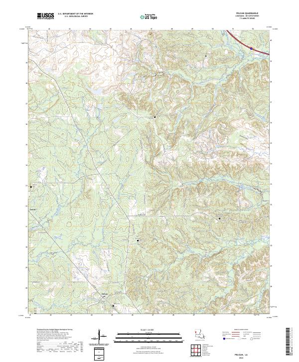
2024 Map of Pelican
USGS Topo · Published 2024About this map
Pelican and Oxford serve as the primary settlement points in this pocket of De Soto Parish, where the local economy and geography are defined by a complex network of bayous and the rising elevations of the Dolette Hills. The landscape is etched with the courses of West Branch Dolet Bayou, Brushy Bayou, and Rombin Bayou, creating a segmented terrain that historically dictated the placement of roads and homesteads. For genealogists, the map is remarkably dense with burial sites and landmarks, including Zion Hill Cem, Grove Hill Cem, Saint Paul Cem, and Saint Matthew Church (Cem). The presence of the DeSoto Fire Tower on a high point north of Grove Hill RD highlights the importance of forestry management in this timber-rich region, while the persistence of names like Old Jefferson RD and Ramblin RD suggests long-established corridors of travel through the Louisiana backcountry.
Find a feature on this map
53 named features on this map. Tap any name to fly to it.
Don’t see what you’re looking for? This feature index may not catch every label — zoom into the map to look around manually.
Map Details
Editions of this 2024 Pelican Map
This is the sole edition of this map. No revisions or reprints were ever made.
Other maps of this area

1938 · Chemard Lake
USGS Topo · 1:31,680

1938 · Hollis Creek
USGS Topo · 1:31,680

1941 · Pelican
USGS Topo · 1:62,500

1943 · Pleasant Hill
USGS Topo · 1:62,500

1944 · Pleasant Hill
USGS Topo · 1:62,500

1945 · Mansfield
USGS Topo · 1:62,500

1947 · Mansfield
USGS Topo · 1:62,500

1947 · Hanna
USGS Topo · 1:62,500

1948 · Coushatta
USGS Topo · 1:62,500

1953 · Alexandria
USGS Topo · 1:250,000