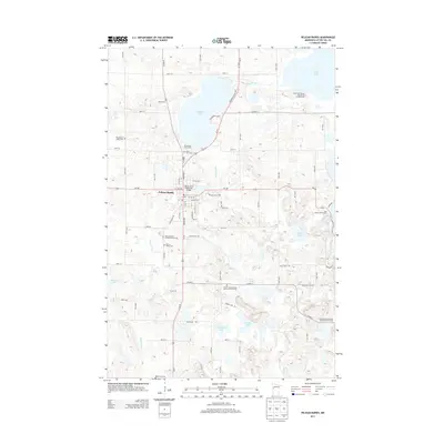
2013 Map of Pelican Rapids
USGS Topo · Published 2013About this map
The Pelican Rapids settlement serves as the central hub of this lake-strewn Otter Tail County landscape, where the Pelican River snakes through a series of significant water bodies including Prairie Lake and Lake Lizzie. The map reveals a high concentration of pioneer and community burial grounds, such as the Saint Leonard's Catholic Church Cem and Central Swede Grove Lutheran Church Cem, suggesting a long-established rural population with deep denominational roots. The presence of the Scandinavian Christian Mission Church Cem specifically reflects the Northern European immigrant heritage common to this part of Minnesota.
Find a feature on this map
47 named features on this map. Tap any name to fly to it.
Don’t see what you’re looking for? This feature index may not catch every label — zoom into the map to look around manually.
Map Details
Editions of this 2013 Pelican Rapids Map
This is the sole edition of this map. No revisions or reprints were ever made.
Other maps of this area

1912 · Vergas
USGS Topo · 1:62,500

1913 · Fergus Falls
USGS Topo · 1:62,500

1914 · Pelican Rapids
USGS Topo · 1:62,500

1915 · Underwood
USGS Topo · 1:62,500

1915 · Vergas
USGS Topo · 1:62,500

1917 · Pelican Rapids
USGS Topo · 1:62,500

1953 · Fargo
USGS Topo · 1:250,000

1953 · Brainerd
USGS Topo · 1:250,000

1956 · Fargo
USGS Topo · 1:250,000

1957 · Brainerd
USGS Topo · 1:250,000
Featured Places
- Pelican Rapids, MN
- Pelican Rapids Mobile Home Park, Pelican Rapids
- Otter Tail County, MN
- United States
- Minnesota