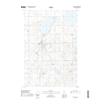
2019 Map of Pelican Rapids
USGS Topo · Published 2019About this map
Pelican Rapids serves as the focal point of this Otter Tail County landscape, where the Pelican River flows through a series of significant glacial water bodies. The settlement's industrial roots are visible near the river at the E Mill, while its community infrastructure includes the Rotary Club Suspension Bridge. The surrounding terrain is defined by a dense network of lakes, including the large Prairie Lake and Lake Lizzie, which have shaped the local road system and residential patterns.
Find a feature on this map
49 named features on this map. Tap any name to fly to it.
Don’t see what you’re looking for? This feature index may not catch every label — zoom into the map to look around manually.
Map Details
Editions of this 2019 Pelican Rapids Map
This is the sole edition of this map. No revisions or reprints were ever made.
Other maps of this area

1912 · Vergas
USGS Topo · 1:62,500

1913 · Fergus Falls
USGS Topo · 1:62,500

1914 · Pelican Rapids
USGS Topo · 1:62,500

1915 · Underwood
USGS Topo · 1:62,500

1915 · Vergas
USGS Topo · 1:62,500

1917 · Pelican Rapids
USGS Topo · 1:62,500

1953 · Fargo
USGS Topo · 1:250,000

1953 · Brainerd
USGS Topo · 1:250,000

1956 · Fargo
USGS Topo · 1:250,000

1957 · Brainerd
USGS Topo · 1:250,000
Featured Places
- Pelican Rapids, MN
- Pelican Rapids Mobile Home Park, Pelican Rapids
- Otter Tail County, MN
- United States
- Minnesota