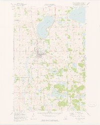
1973 Map of Pelican Rapids
USGS Topo · Published 1975About this map
Pelican Rapids serves as the focal point of this west-central Minnesota landscape, situated at a transition between the Pelican River valley and the expansive lake country of Erhards Grove and Maplewood. The 1970s infrastructure shows a community well-supported by local landmarks, including the Golf Course and several regional burial grounds such as Lake View Cem and Pelican Valley Cem.
Find a feature on this map
32 named features on this map. Tap any name to fly to it.
Don’t see what you’re looking for? This feature index may not catch every label — zoom into the map to look around manually.
Map Details
Editions of this 1973 Pelican Rapids Map
This is the sole edition of this map. No revisions or reprints were ever made.
Other maps of this area

1912 · Vergas
USGS Topo · 1:62,500

1913 · Fergus Falls
USGS Topo · 1:62,500

1914 · Pelican Rapids
USGS Topo · 1:62,500

1915 · Underwood
USGS Topo · 1:62,500

1915 · Vergas
USGS Topo · 1:62,500

1917 · Pelican Rapids
USGS Topo · 1:62,500

1953 · Fargo
USGS Topo · 1:250,000

1953 · Brainerd
USGS Topo · 1:250,000

1956 · Fargo
USGS Topo · 1:250,000

1957 · Brainerd
USGS Topo · 1:250,000
Featured Places
- Pelican Rapids, MN
- Pelican Rapids Mobile Home Park, Pelican Rapids
- Otter Tail County, MN
- United States
- Minnesota