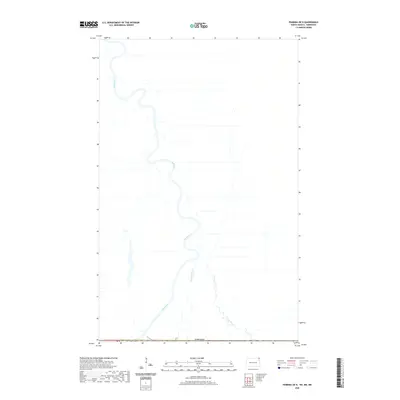
2020 Map of Pembina OE N
USGS Topo · Published 2020About this map
The Red River dominates this international border landscape, winding north across the boundary between the United States and Canada. This survey, produced by the U.S. Geological Survey using data through 2018, documents a sparse, water-defined terrain where the river’s complex meanders create a series of points and bends along the 49th parallel. Small tributaries like Bradley Coulee and the Joe River feed into the main channel, illustrating the hydrologic patterns of the Red River Valley. The land is marked by the rectilinear grid of the Public Land Survey System, specifically t164n r51w, showing the enduring influence of early township and range divisions on the modern North Dakota and Minnesota borderlands.
Find a feature on this map
5 named features on this map. Tap any name to fly to it.
Don’t see what you’re looking for? This feature index may not catch every label — zoom into the map to look around manually.
Map Details
Editions of this 2020 Pembina OE N Map
This is the sole edition of this map. No revisions or reprints were ever made.
Other maps of this area

1939 · Pembina
USGS Topo · 1:62,500

1941 · Bathgate
USGS Topo · 1:62,500

1941 · Pembina
USGS Topo · 1:62,500

1952 · Thief River Falls
USGS Topo · 1:250,000

1956 · Thief River Falls
USGS Topo · 1:250,000

1957 · Thief River Falls
USGS Topo · 1:250,000

1967 · Thief River Falls
USGS Topo · 1:250,000
1970 · Bathgate NE
USGS Topo · 1:24,000
1972 · Pembina
USGS Topo · 1:24,000
1974 · Humboldt
USGS Topo · 1:24,000