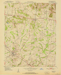
1951 Map of Pembroke
USGS Topo · Published 1951About this map
The Jefferson Davis Monument stands as a prominent landmark at the border of Christian and Todd counties in the early 1950s. This survey centers on the agricultural lands between Fairview and Pembroke, a landscape defined by the intersection of the Jefferson Davis National Highway and the Louisville and Nashville railroad. The geography is marked by the winding courses of the South Fork Little River and the West Fork Red River, with several family and community burial grounds, such as Shanklin Cem and Rawlins Cem, scattered among the farms.
Find a feature on this map
25 named features on this map. Tap any name to fly to it.
Don’t see what you’re looking for? This feature index may not catch every label — zoom into the map to look around manually.
Map Details
Editions of this 1951 Pembroke Map
2 editions found
Other maps of this area

1944 · Clarksville
USGS Topo · 1:50,000

1950 · Guthrie
USGS Topo · 1:24,000

1950 · Pembroke
USGS Topo · 1:24,000

1951 · Pembroke
USGS Topo · 1:24,000

1951 · Elkton
USGS Topo · 1:24,000

1951 · Hopkinsville
USGS Topo · 1:24,000

1951 · Hammacksville
USGS Topo · 1:24,000

1951 · Oak Grove
USGS Topo · 1:24,000

1952 · Kelly
USGS Topo · 1:24,000

1952 · Allegre
USGS Topo · 1:24,000